Topocad 26 is here!

The new version includes many exciting updates. We have refined and improved the workflows in Topocad, and taken major steps forward in point cloud vectorization, IFC 4.3, railway design, and solid handling.
The result is Topocad 26 — a release we hope will make your work better, with fewer clicks and smoother workflows. Below, you can read about the new features and watch the video where we show the updates from inside Topocad.
- Download Topocad 26 here.
- All news in Topocad 26.
- Watch demo from inside Topocad 26 (4 min).
- Order try out version of Topocad 26
From point clouds to vectorized 3D buildings
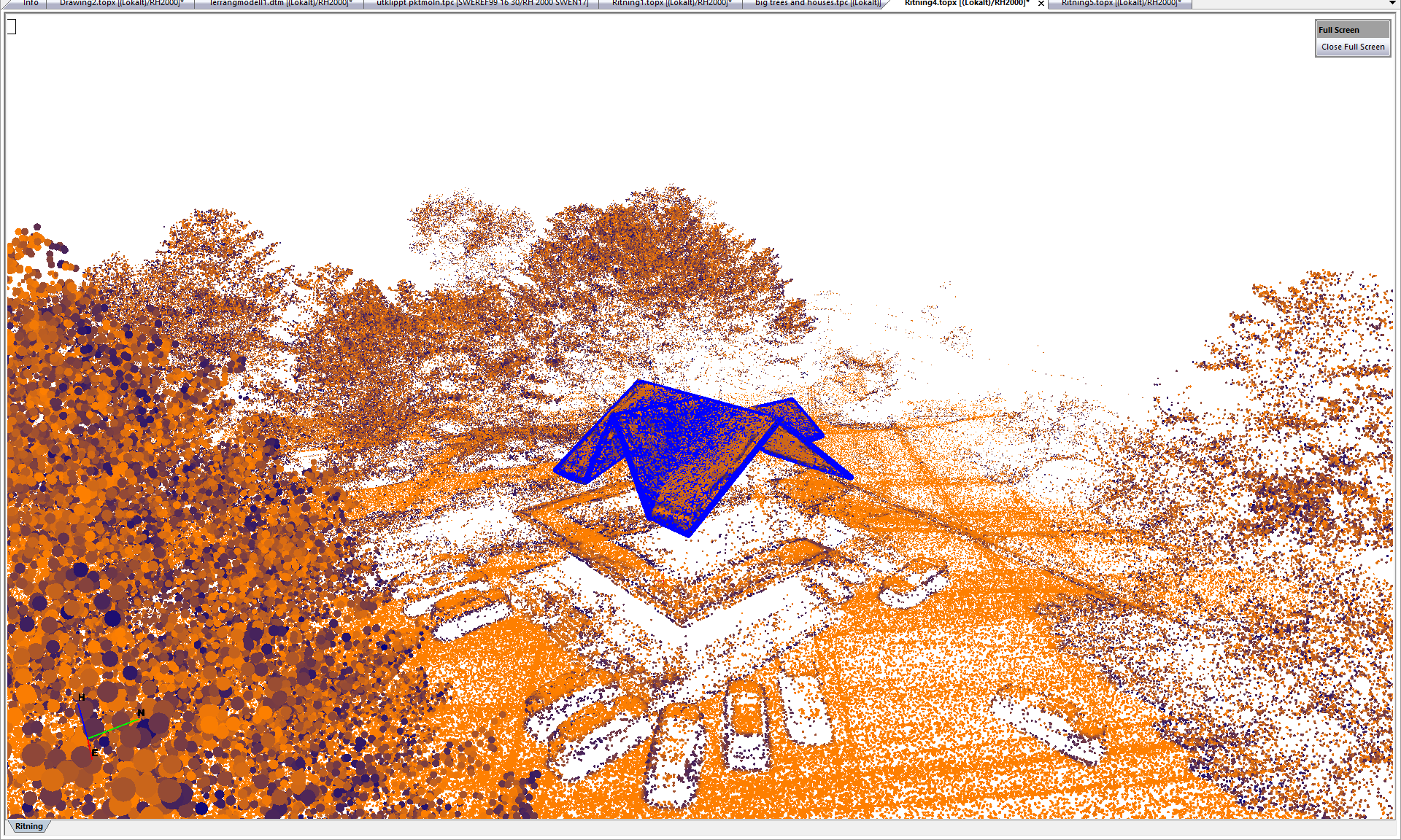
A major new feature is the ability to extract surfaces directly from point clouds. Topocad can automatically interpret surfaces, and then, using the command, you can connect the surfaces to create, for example, a building. The function offers excellent opportunities to capture many details, such as roof overhangs on buildings.
IFC for verification surveying and BIM
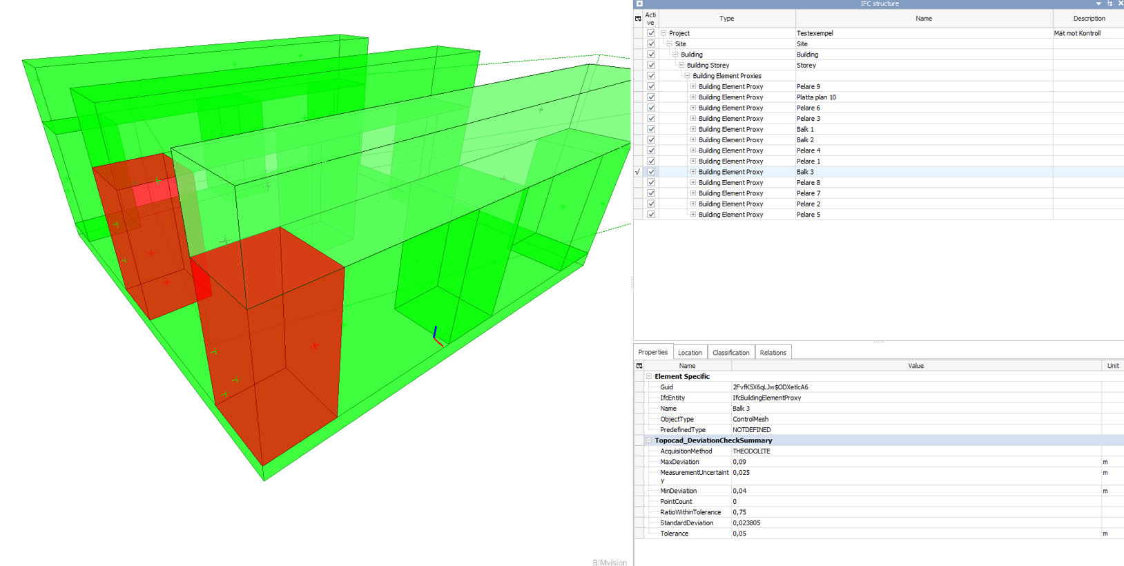
Topocad 26 also takes a major step forward in IFC. With new solid functions, survey points or point clouds can be compared against solids in a building model. Deviations are displayed visually using color coding, can be compiled in a report, and can be included in the IFC file. This brings surveying technology into the world of BIM!
Export point clouds and terrain models to the drawing
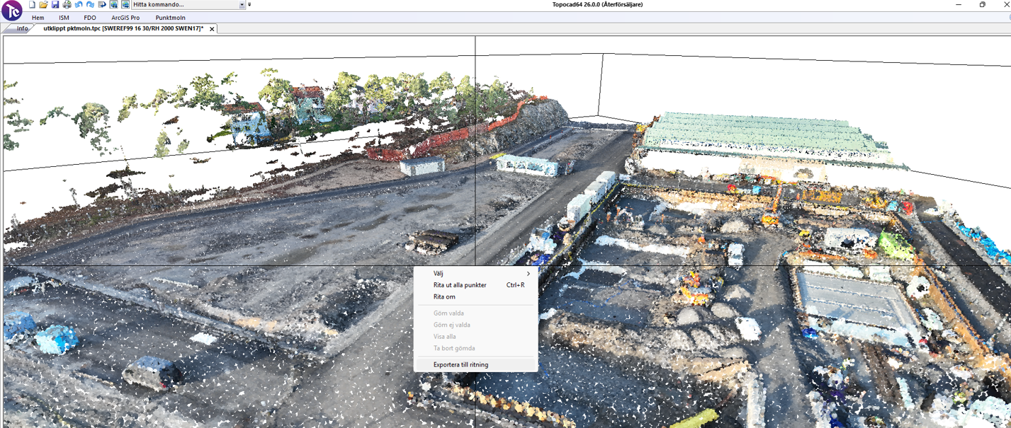
The workflow between drawings and other documents has also become smoother. In the previous version, it became possible to send data from the drawing to terrain models, point clouds, and geometry files. In Topocad 26, this now works in the other direction as well: you can right-click in these documents and export data to a drawing.
Railway design
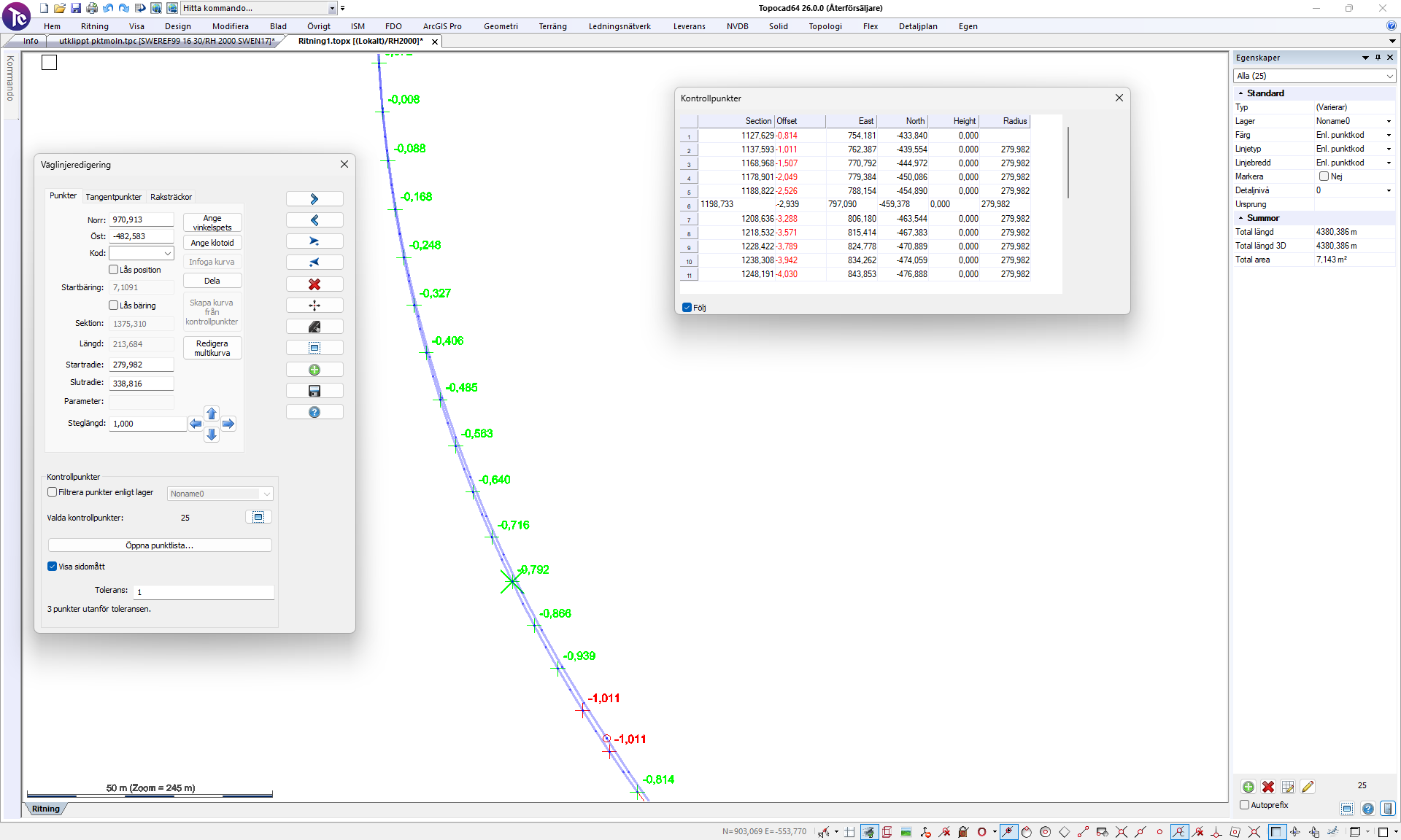
For those working with railways, Topocad now includes a major reworked tool for designing alignments. You can follow control points, view pre-calculated radii, auto-generate curves, and create multi-curves. Deviations are displayed directly in the drawing and in the profile form when designing profile elevations.
GeoPackage and map services
In version 26, you can import GeoPackage (.gpkg), an exchange format for GIS data. It is an open and modern format that is often requested by municipalities and suppliers.
The handling of map services (WMS) has been improved, with faster loading and better control over which layers are displayed at different zoom levels.


Would you like to receive information about our product news and events?
Subscribe to our newsletter!