From design to reality: Topocad and the surveyor’s role in Hagastaden

In Hagastaden, Stockholm is growing both upwards and downwards. From tunnels far below ground to new blocks with modern high-rise buildings above, a new city district is taking shape. It is a project that places high demands on surveying.
Here, it is not enough to measure correctly. You also need to understand how each decision will work in real life. This is where the role of the surveyor becomes more important than many people might think.
Hagastaden is one of Stockholm’s largest urban development projects. Where freight trains once passed through the area, a completely new part of the city is now being built. The E4/E20 motorway and the Värtabanan railway have been placed in tunnels, and on top of the approximately 800-metre-long decking, new homes, workplaces, parks and squares are emerging. The area also connects the city more closely with Karolinska University Hospital Solna and the district for research, healthcare and life science.
We meet Hagastaden’s surveying coordinators, Fredrik Landqvist and Håkan Rampell, to talk about the role of surveying in the project. Both work as client-side support on behalf of the Development Administration at the City of Stockholm.
Fredrik and Håkan have many years of experience in surveying, but also in production. When they survey, they understand what the designer needs to get from the data. They also know what works on site, and which details can lead to major consequences later in the project.
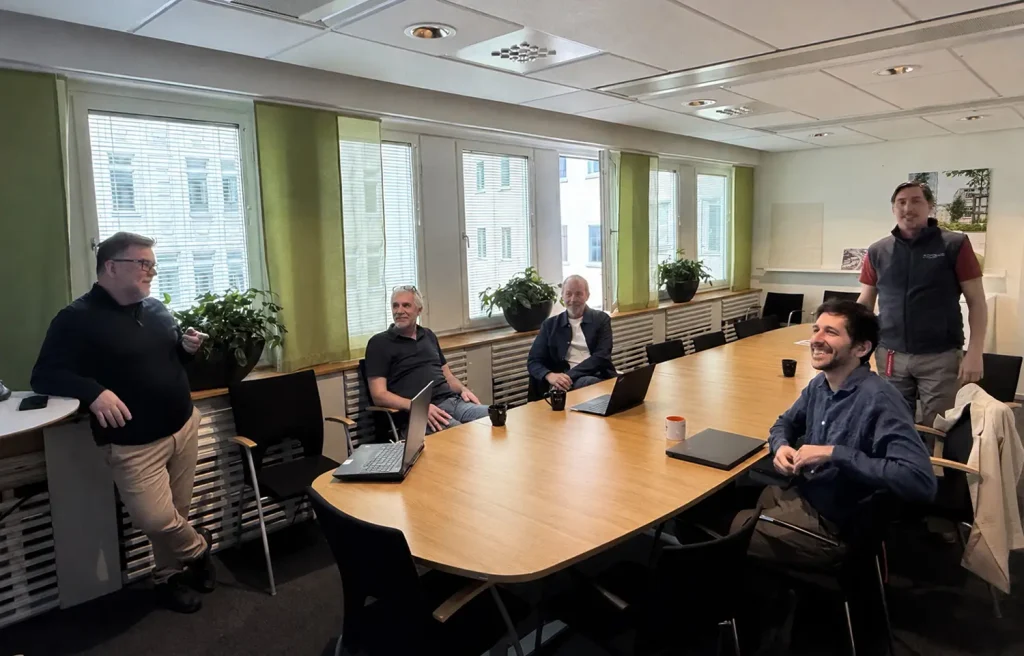
Fredrik Landqvist, Håkan Rampell and Krister Arnaryd discuss data flows and surveying technology with Jakob Samani and Nicklas Lundström from Adtollo.
The details make the difference
As the project moves into its next phase, existing buildings will be demolished. Fredrik shows an Excel file where he has estimated different types of material, including asphalt from pavements. It is time-consuming work, but it is important because it affects both cost and environmental impact.
What needs to go to landfill? What can be reused? What needs to be bought in? Fill material and landfill are expensive, and hazardous material is even more costly to handle.
“Nobody wants to talk about the details, but that is where the costs are decided,” says Håkan.
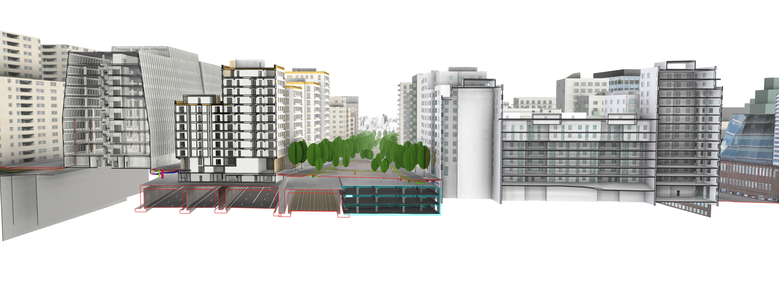
A 3D cross-sectional model of Hagastaden.
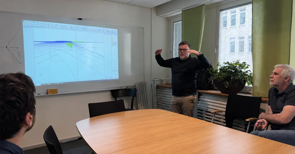
Topocad – when every line needs to be traceable
In a complex project like Hagastaden, information comes from many different sources: scanning, drones, design maps, surveyed terrain models and designed infrastructure models. All this information needs to be managed, understood and used further in the project.
This is where Topocad has become an important tool in the daily work.
A key part of the workflow is that lines and points in the design map include information such as who carried out the survey, what type of instrument was used and when the measurement was made. This makes the information traceable and easier to understand throughout the project.
The design map is created and continuously updated in Topocad, which becomes a central point for information management. In Topocad, Fredrik and Håkan build terrain models, manage design data in 3D and create production models that are used later in the construction phase.
In Hagastaden, this traceability is especially important. Tunnels, decking, new streets, utilities, property boundaries and buildings all exist close together. A height difference of 50 centimetres can cause problems for drainage and accessibility. Moving an entrance can have major consequences when the street is sloping. And below ground, there are both known and unknown conditions that must be considered in design and production.
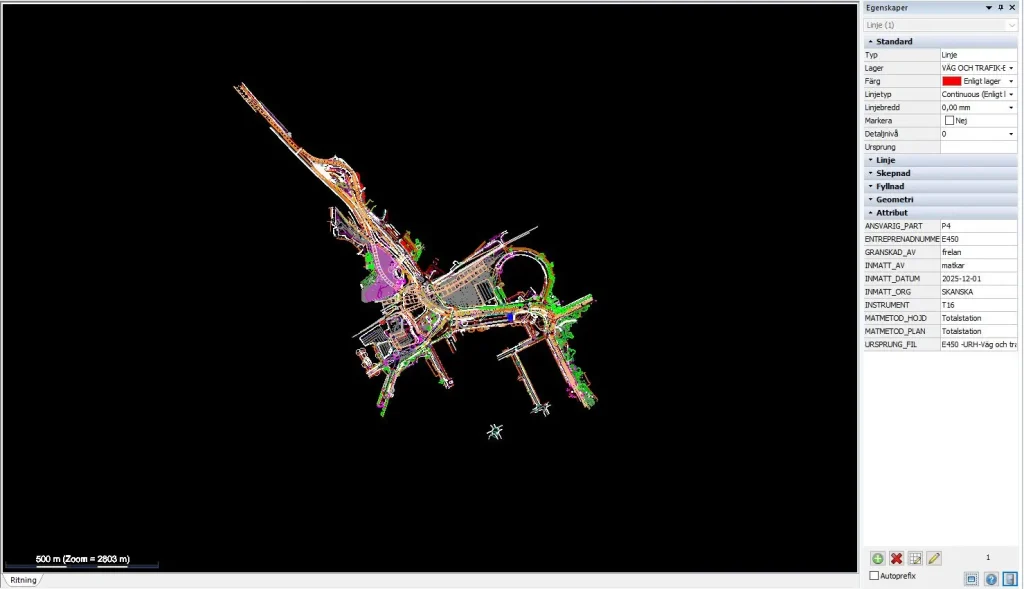
All surveys are collected in the design map.
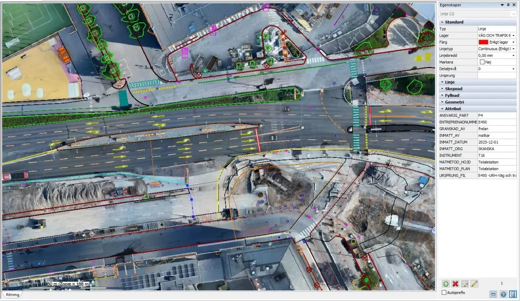
Surveyed objects are marked with attributes such as date, who carried out the survey, measurement method and original file.
The surveyor as a requirements setter
Krister Arnaryd from BIM Alliance also takes part in the conversation. He works with questions related to surveying, standards and skills development. He believes Hagastaden is a clear example of why surveying expertise needs to be involved earlier in projects.
“The key is knowing how to define the requirements,” he says.
He believes the industry needs a clearer coordinating role. This role should be filled by someone who understands the data flow, can define clear requirements and makes sure that the right information is available in the right model. It is not only about collecting data. It is also about understanding how the information will be used later.
Both Krister and Fredrik return to the need for a role that combines surveying knowledge, production experience and an understanding of quantities. In other countries, there is often a quantity manager who is responsible for quantities and cost-related documentation, without being a surveyor. In Sweden, however, the surveyor is often the person with the best overview of the quantities.
“Raise the status of the surveyor,” Krister summarises.
This issue is also bigger than Hagastaden. Within BIM Alliance, work is ongoing around education, standards and data flows in surveying. Both Krister and Adtollo are involved in this work. Jakob Samani from Adtollo is one of the people driving discussions on how survey data can be structured and used more effectively throughout the construction process.
Better models start with better conversations
The importance of being involved early in the project comes up several times during the day. Many mistakes do not start on the construction site. They start much earlier: when models do not include the right information, when quantities have not been properly considered, or when different parties do not really talk to each other.
Fredrik describes what is needed:
“Instead of long email threads, we need more face-to-face conversations, more shared understanding and greater respect for how information is actually used in production.”
This may be one of the most important points in the whole conversation. Technology is central, but it cannot solve everything on its own. For models to be useful, people also need to communicate, understand each other’s needs and respect how the information will be used.
In Topocad, Fredrik and Håkan build terrain models, manage design data in 3D and create production models that are used later in the construction phase.
The production model becomes a shared basis for work
In Hagastaden, production models have been created based on both designed infrastructure models and surveyed terrain models. The models have been approved as construction documents and are then used both in the tender phase and during production for setting out, machine control and quantity regulation.
This means that several parties do not have to build the same models themselves. It saves time, reduces the risk of errors and helps ensure that the calculations are based on the same model that is used for construction.
For the models to work well in practice, there is also a need for object-specific rules for measurement and compensation. One example is excavation around manholes. Here, the aim is to be able to create slopes in the production model in a way that can be used both for machine control and for quantity regulation.
At the same time, challenges remain. Standards are missing or used in different ways. Naming and coding vary between projects. As Håkan points out, data is not difficult to create. The difficult part is keeping it up to date when reality changes every day on site.
An excavator arrives. Something is moved. Something is adjusted. Suddenly, the data is no longer correct. This is why the information chain needs to be strong.
A tool for reality
Hagastaden clearly shows that complex urban development requires more than simply passing information from one phase to the next. It requires a shared language, an understanding of data flows, the construction process and costs — as well as tools that make the information useful.
Here, surveying becomes more than a technical task. It becomes a link between design and production, and between calculations and reality.


Would you like to receive information about our product news and events?
Subscribe to our newsletter!