User story: How Topocad helps Infranord keep track of the railway

As Sweden’s leading railway contractor, Infranord is responsible for monitoring the country’s railway tracks. With Topocad, they can measure, calculate, and adjust with millimeter accuracy—delivering solutions that work both today and in the long term.
– Topocad is not just a drawing tool, it’s part of how we organize our work, says Michael Persson, site manager at Infranord.
The railway connects Sweden. Every day, people and goods move across a complex network of tracks that must be precise and safe. Infranord plays a key role in building the sustainable infrastructure of the future. Behind every successful track adjustment or on-time departure lies advanced surveying technology and tools that must perform with absolute precision.
– The tolerances in railway work are extremely tight, often only ±10 mm, says Persson. That means we need systems that are both accurate and reliable.
At Infranord, surveyors use Topocad every day. It is central to everything from surveying and track alignment to 3D modeling and network adjustments.
– It’s like having the whole railway project in one piece of software. We build models, run analyses, and send data straight to the alignment machines — all within Topocad.
“Topocad is like a toolbox with everything we need.” Michael Persson, Site Manager at Infranord.
From field survey to finished file
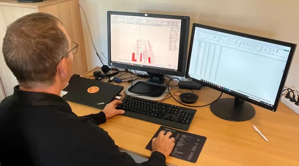
For Infranord’s surveying teams, Topocad is much more than a CAD program. It’s a complete solution for moving projects forward. A typical workflow starts with measuring the track position, comparing it with the theoretical alignment, and generating exact adjustment values that are then sent to the machines.
– We measure how the track lies. The data is processed in Topocad, which quickly shows how much the track needs to be shifted or lifted. We can then deliver those values as a report or as a file straight to the machines, Persson explains.
When new routes or reconstructions are planned, Infranord now calculates the track geometry directly in Topocad. Previously, consultants were needed for this—but today the work is done internally in a fraction of the time.
– A job that once cost several hundred thousand, I can now do myself in Topocad. It’s both efficient and cost-effective.
Topocad is also used to create 3D models that excavators can use for earthworks. And with the network adjustment module, destroyed survey points in the field can be replaced quickly, an important function in daily work.
– The best thing is that everything is connected. We can go from field data to final delivery without switching systems. That makes the work smoother and improves quality.
Before Topocad
When Michael Persson started in the railway industry in 1983, things looked very different. There were no digital models, no ready-made report templates, and certainly no files that could be sent directly to machines.
– We calculated everything by hand: length, direction, coordinates. It was math, paper, and pencil. But I loved it. It really was my dream job.
He began his career as a repair technician at Swedish train operator SJ, but a few years later became one of the first surveyors in a new initiative. After training at the railway school in Ängelholm, he quickly joined a profession that would change completely.
– In the beginning, digital systems were very simple. But we had close contact with the developers at Adtollo, and over time Topocad became exactly the tool we needed.
With today’s technology, Infranord’s survey teams can handle larger volumes, stricter requirements, and shorter lead times, while also documenting everything in a more traceable and professional way. In an industry where safety and precision are critical, that makes a big difference.
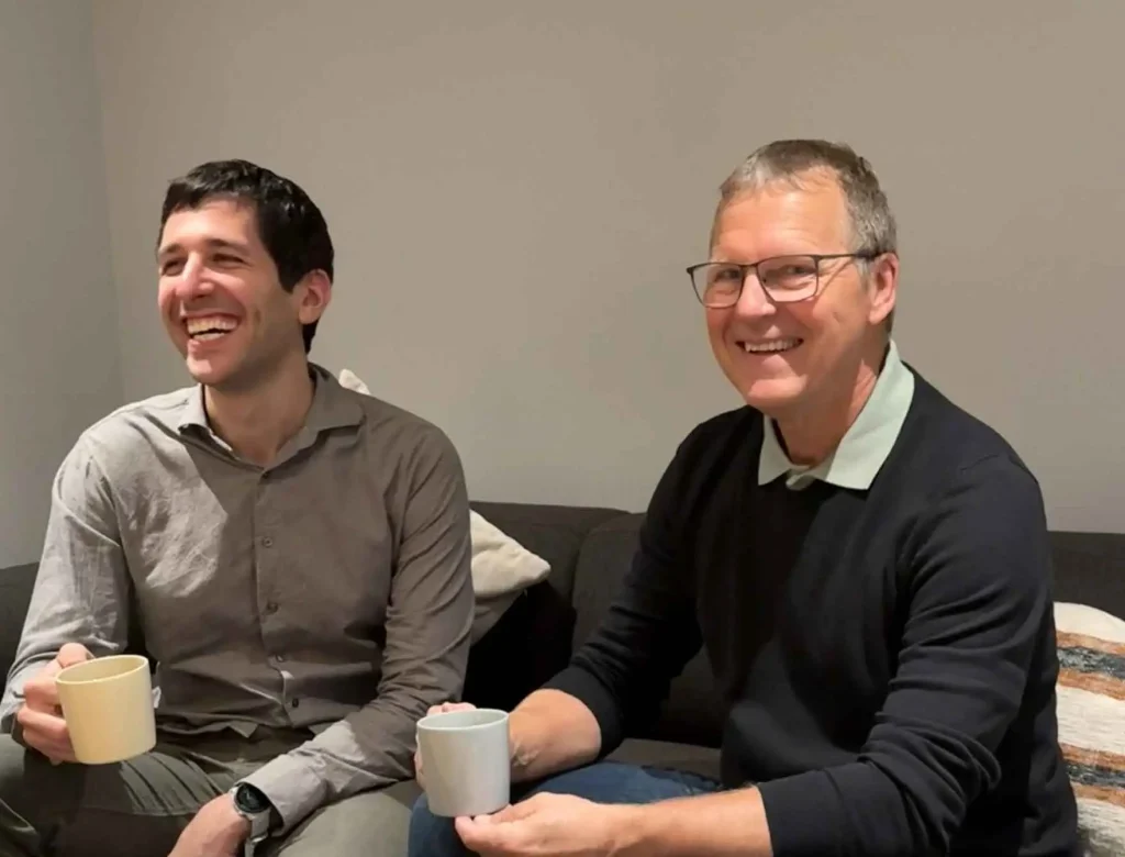
Jakob Samani, Product Manager for Topocad, and Michael Persson, Site Manager at Infranord, have a close collaboration on future development.
A changing railway sector
Over his more than 40 years in the industry, Persson has seen the railway sector change fundamentally. From the days when SJ managed everything, to today’s fragmented structure with separate companies for design, construction, and maintenance—often contracted project by project.
– In the past, you had your own stretch of track and knew every meter of it. There was pride in keeping your section in top condition. Today we move around much more, with projects spread all over the country.
This brings new challenges. Longer travel times, larger work areas, and fewer permanent teams require more efficient tools, better coordination, and digital workflows. That’s why Topocad’s flexibility has become so important.
– It’s not just a drawing tool—it’s part of how we organize the work. What we deliver must last, be clearly documented, and easy to share, whether we’re working in Skåne, Norrland, or in the center of Stockholm.
And the railway is constantly moving—literally. Over time, tracks shift as the ground changes.
– What was built 20 years ago needs to be adjusted so that trains can still run safely today, Persson says.
For him, Topocad is one of the most important tools in the job.
– It’s like a toolbox with everything we need. When the job is done, we know the results will hold up—both now and in the future.
“Everyone Should Travel by Train”
Even though railway projects have become more complex, one thing hasn’t changed: the will to create value for society.
– What we do is important. When we build or adjust tracks, we make sure that people, businesses, and communities can function.
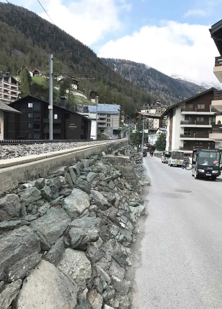
And despite decades in the industry, despite digitalization and organizational changes, one thing has remained the same: the love of trains. Persson celebrated his 60th birthday with a trip on the Glacier Express in Switzerland—one of Europe’s most spectacular railway lines.
– There’s something special about getting on board, leaning back, and rolling through the landscape. And you arrive well-rested. Everyone should travel by train, says Michael Persson.


Would you like to receive information about our product news and events?
Subscribe to our newsletter!